
Mapping Analog Forestry to Support Ecosystem Restoration in Nuevo Mundo, Ecuador
Analog forestry seeks to establish ecosystems with architectural structures and ecological functions similar to the original vegetation. It is a complex form of agroforestry, where ecosystems are dominated by trees offering species with marketable value, providing socioeconomic sustenance to rural communities.
 Analog forestry aims to get almost similar conditions as a pristine forest
In the surroundings of the community of Nuevo Mundo in the province of Pichincha (Ecuador), tropical evergreen forests still persist, reaching heights of 20–35 meters. Epiphytes are abundant, and there is a significant diversity of orchids, bromeliads, mosses, and ferns. However, commonly occurring land-use changes threaten this ecosystem. Analog forestry could provide a solution by offering resources to the community while protecting the forest.
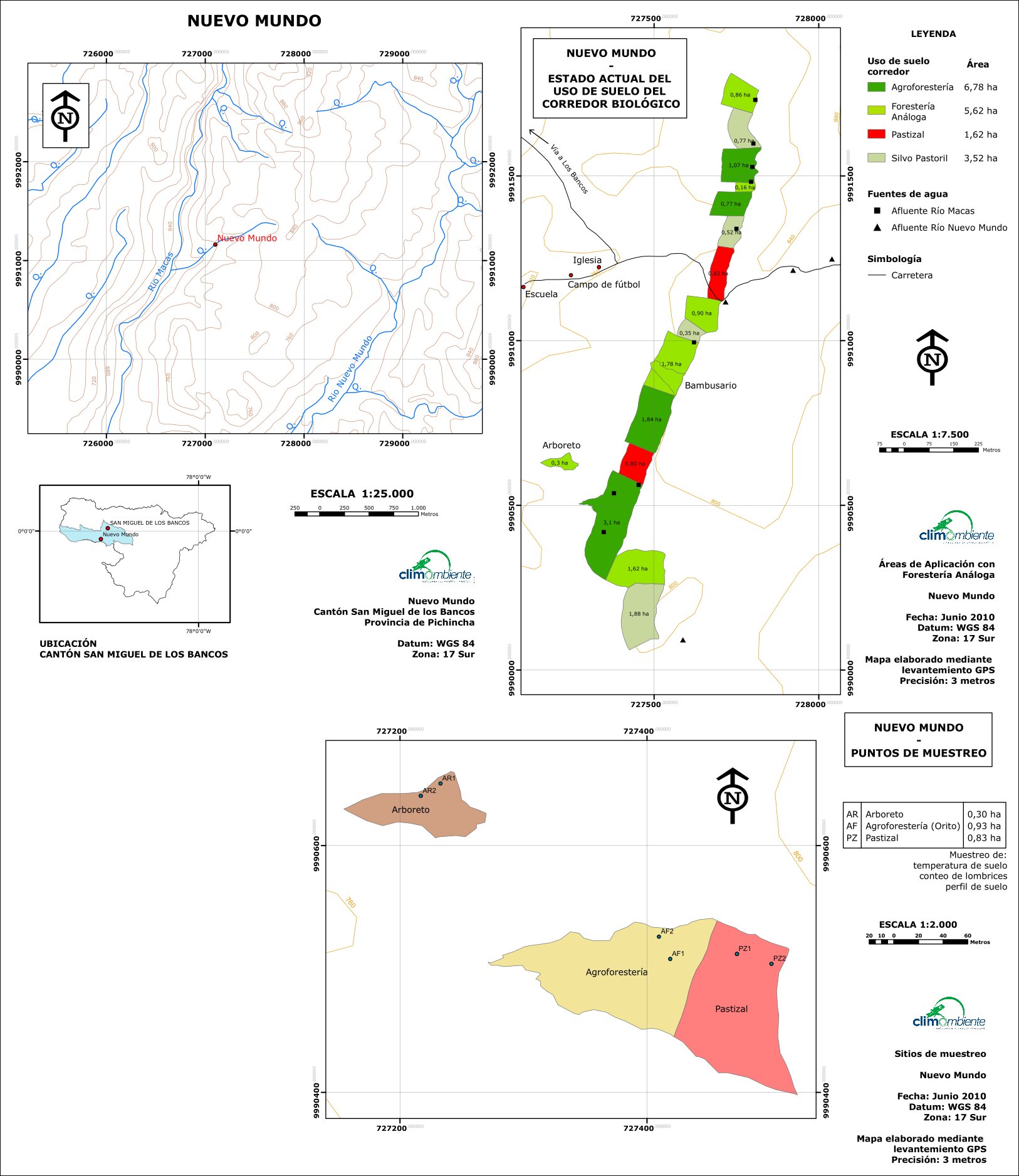
The objective of this project was to map the areas where analog forestry was implemented. Information was collected in situ with contributions from the Nuevo Mundo community. Plots with analog forestry and the current land uses of the surrounding areas were mapped using global positioning systems (GPS). The georeferenced data were imported into a GIS, and cartography was developed using secondary information provided by the Instituto Geográfico Militar (IGM). Areas of interest were calculated, and land use was mapped by category.