The Role and Application of Atmospheric Correction in Remote Sensing
Atmospheric correction is often regarded as one of the most critical components of pre-processing in the analysis of remotely sensed data. Atmospheric effects or physical limitations frequently degrade the energy captured by sensors. To extract more accurate reflectance from ground objects, atmospheric correction reduces or eliminates the distortions added to the pure signal of an object by the atmosphere.
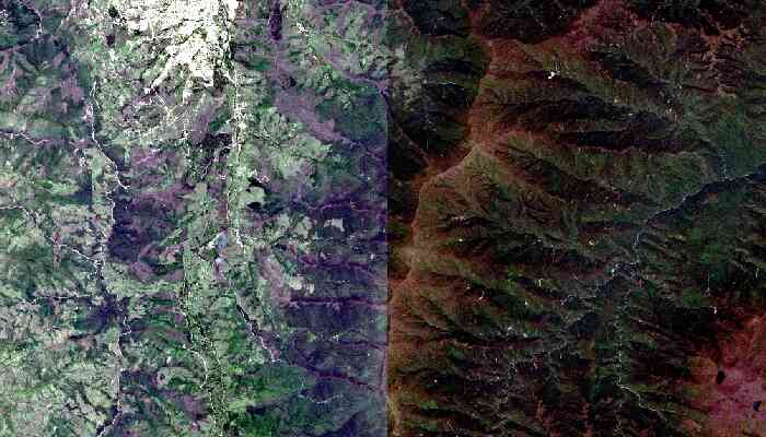
 Spectral reflectance before and after the atmospheric correction
However, the need for atmospheric correction depends on the specific application, and it is not always required. For instance, this correction is often essential when comparing multi-temporal images (e.g., for change detection), performing scene matching (e.g., for mosaics), or utilizing vegetation indices. In cases where ground reflectance calculations or comparisons between satellite radiance and ground reflectance measurements are involved, atmospheric correction becomes indispensable.
Top-of-the-atmosphere reflectance, haze removal, cloud masking, ground reflectance, and topographic correction are all components of atmospheric correction. A Digital Elevation Model (DEM) with the same spatial resolution as the uncorrected image is essential for performing these corrections effectively.