Application of Green-LiDAR for Monitoring Aquatic Reed Bed Dynamics: Mapping Structure and Extent
this research study can be found here
Vegetation monitoring is crucial for tracking expansion, deterioration, and overall health. This study investigated the applicability of Green-LiDAR data for assessing the status of aquatic reed beds. The focus was on mapping key structural parameters of aquatic reed beds using 3D data obtained from the Green-LiDAR system. The data revealed morphological and phenological traits of aquatic reeds, which were then used for validation. To automate the classification of aquatic reed bed spatial extent, density, and height, a rule-based algorithm was developed.
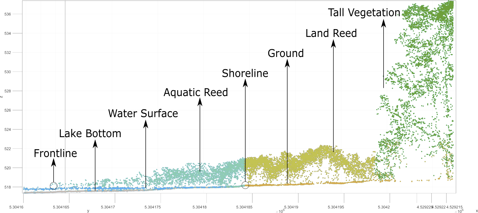 Classification of LiDAR point clouds
The LiDAR data enabled accurate delineation of the aquatic reed bed frontline and shoreline, providing precise quantification of their extent.
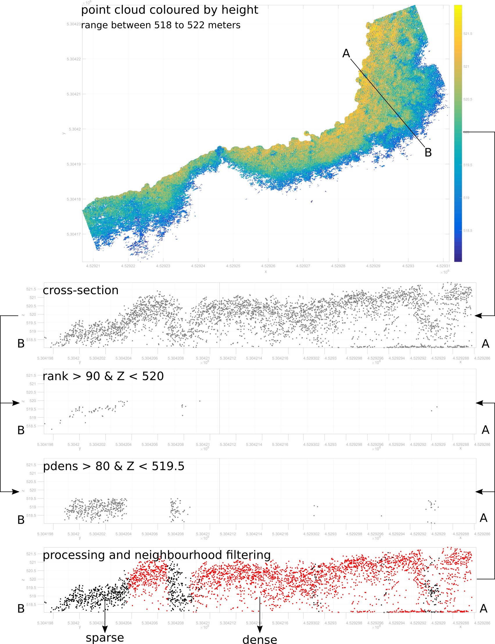 Classification of Sparse Aquatic Reed beds according to stem height below 2 m, density of points under a height of 1.50 m
In comparison to traditional field measurements, aerial laser scanning provided valuable insights without disturbing the habitat. The application of our classification procedure enhanced the efficiency, reproducibility, and accuracy of quantifying and monitoring aquatic reed beds.
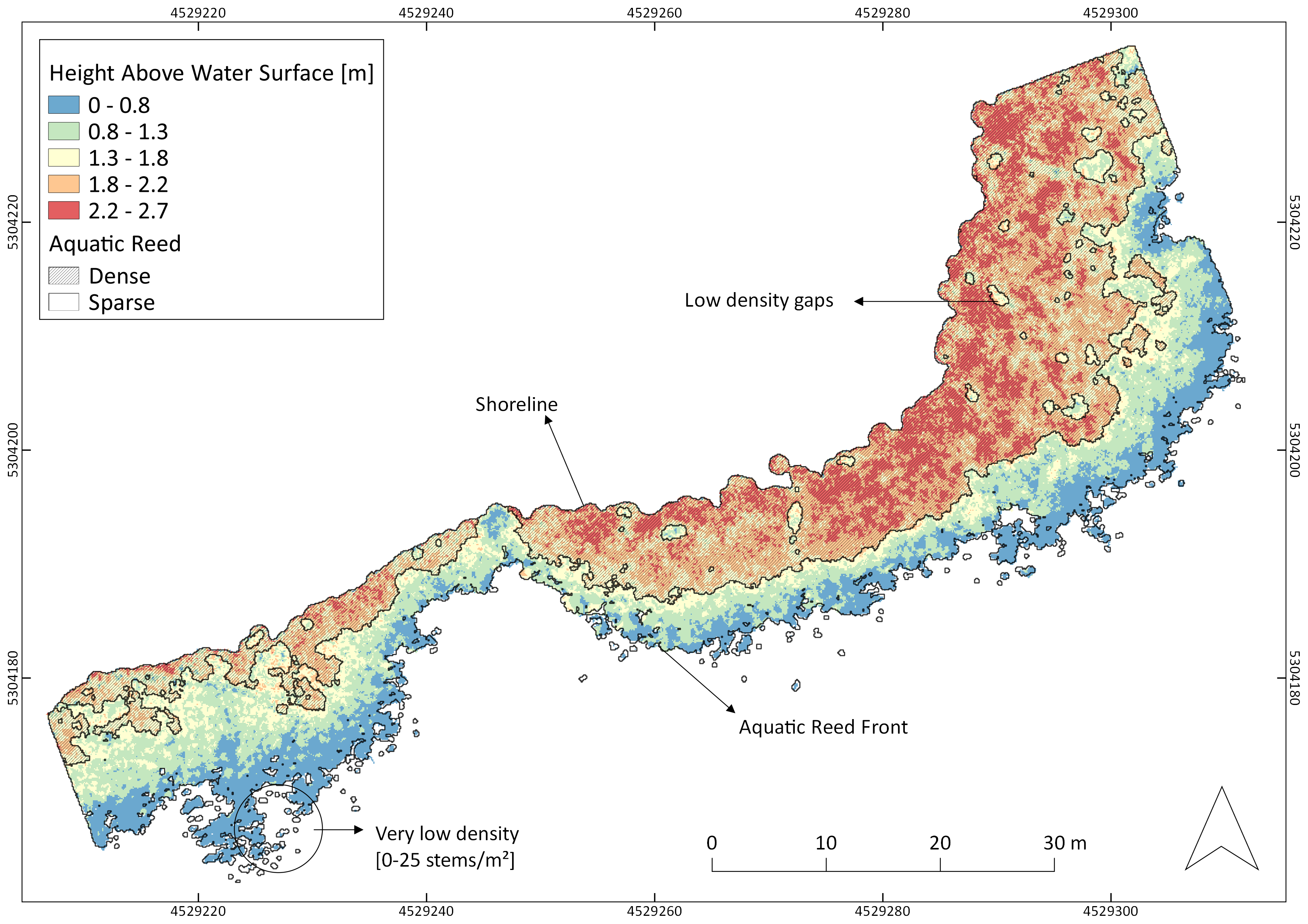 Classification of dense and sparse aquatic aquatic reeds