Affordable Aerial Mapping: Design and Construction of a Budget-Friendly Quadcopter
The project focuses on the design and construction of a low-budget quadcopter specifically built for close-range aerial photogrammetry. By utilizing cost-effective materials and components, the goal is to create an affordable yet reliable drone capable of capturing high-quality aerial images for mapping and surveying applications. This project combines practical engineering solutions with efficient technology, making aerial photogrammetry accessible for smaller-scale operations or research in fields where budget constraints are a key factor.
Key features of the project included:
- Electronics: I integrated an affordable GPS module, telemetry system, and a compact camera for mapping purposes.
- Construction Tips: I used 3D-printed parts for critical joints to enhance durability while keeping costs down.
- Software: Open-source flight software like ArduPilot was customized for precise navigation and mapping missions.
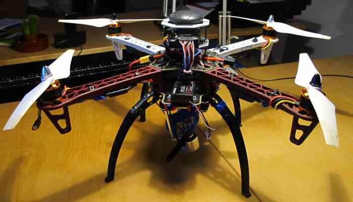
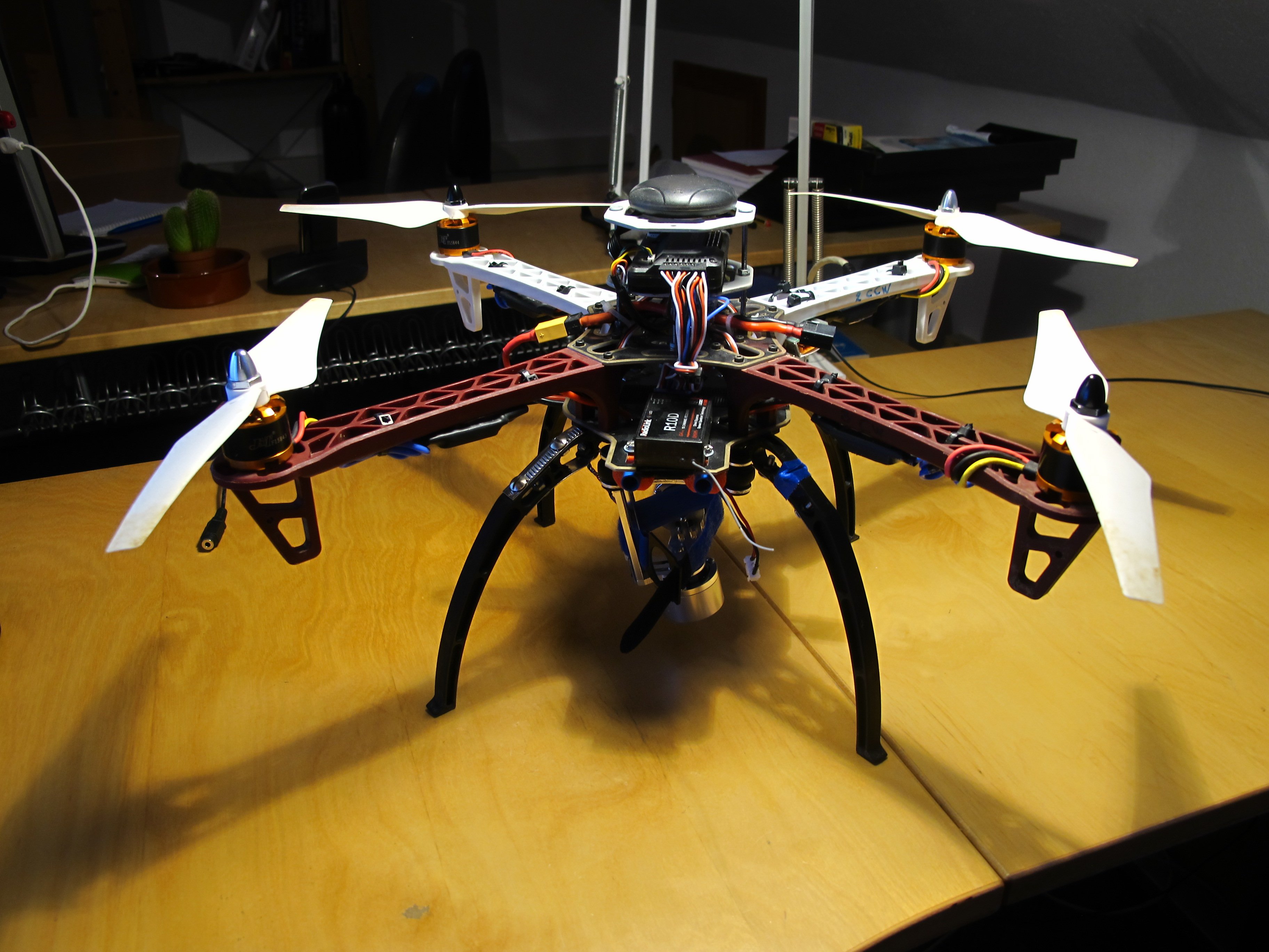 final presentation
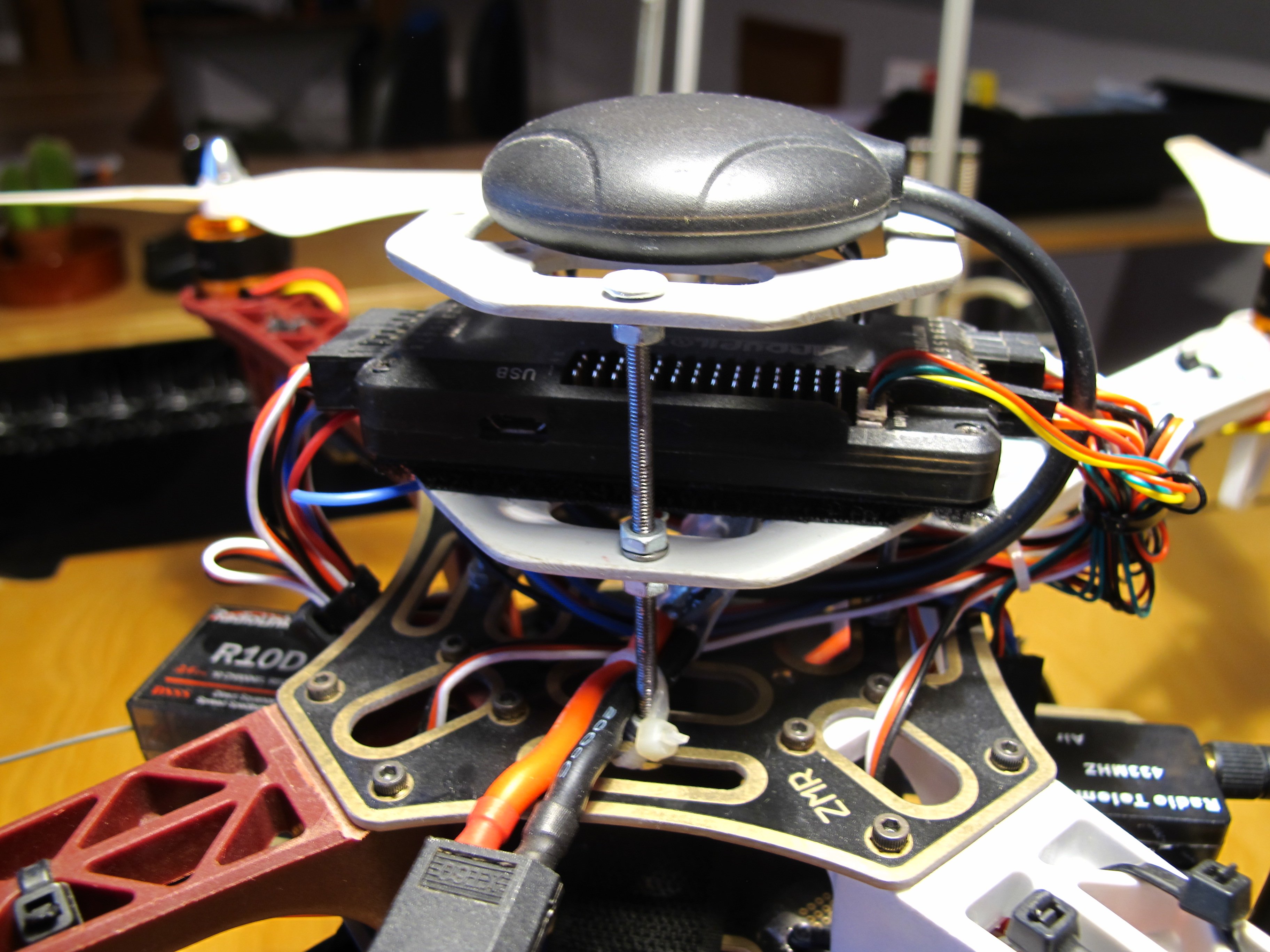 GPS and Flight controller
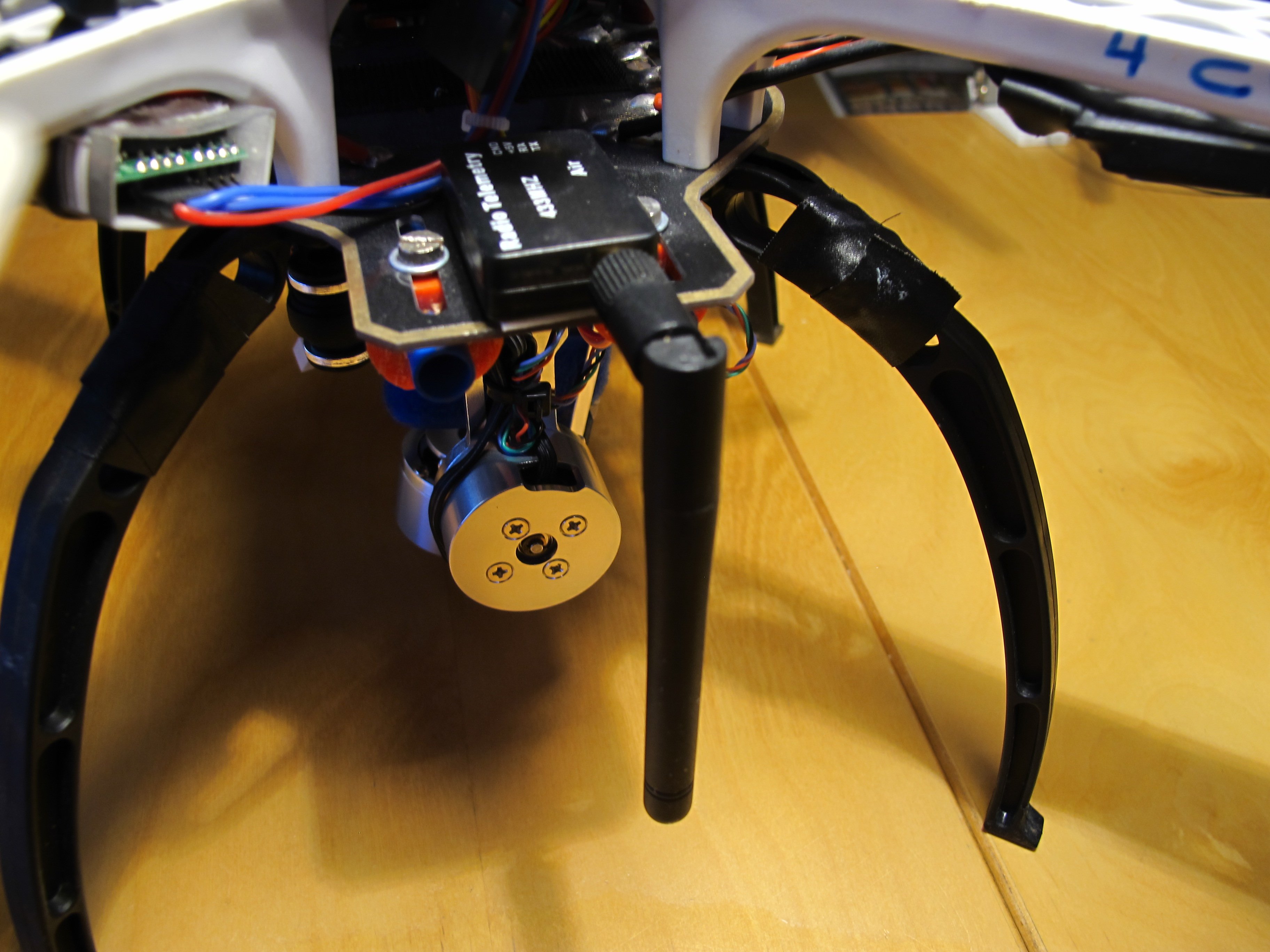 Telemetry for data transfer
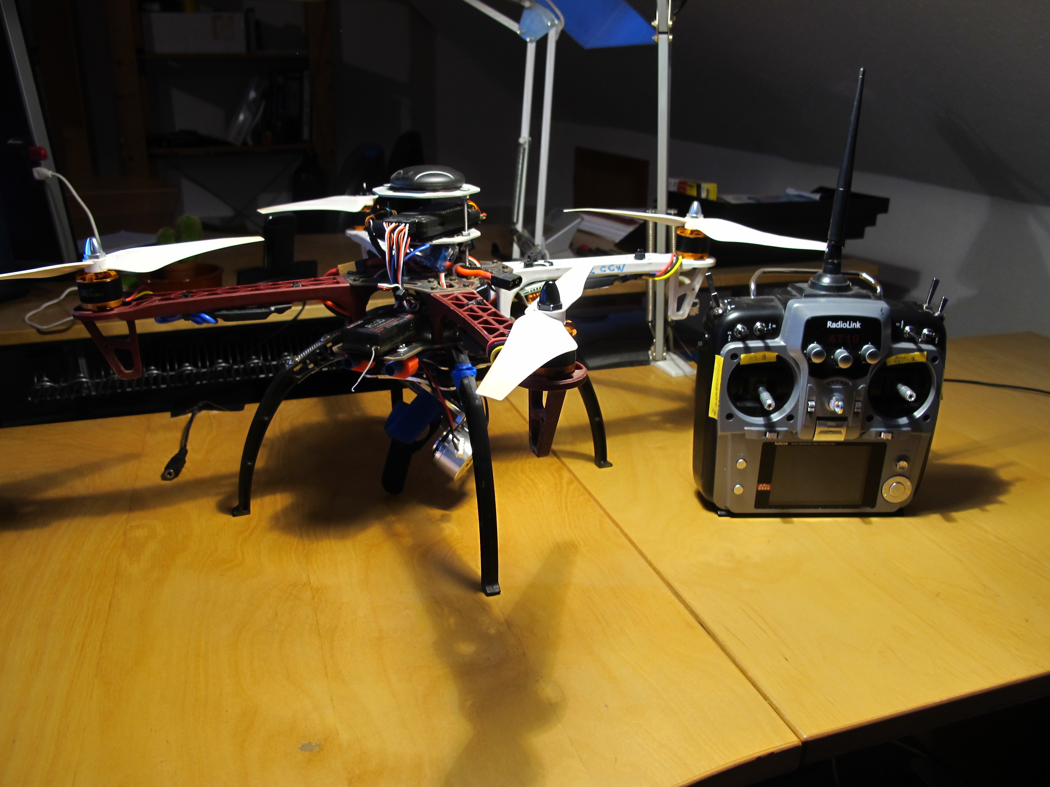 Radio Control System
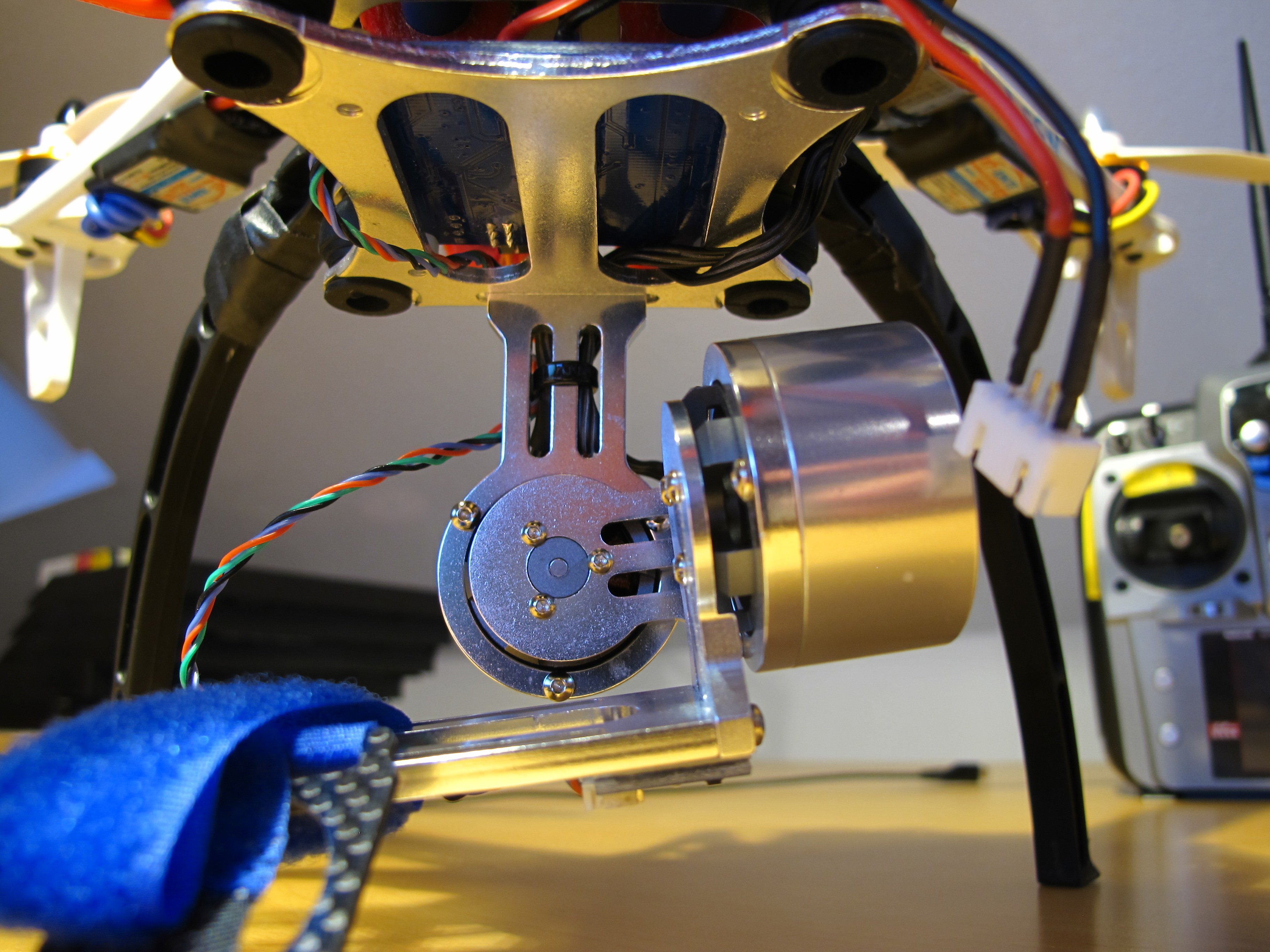 2-Axis Gimbal
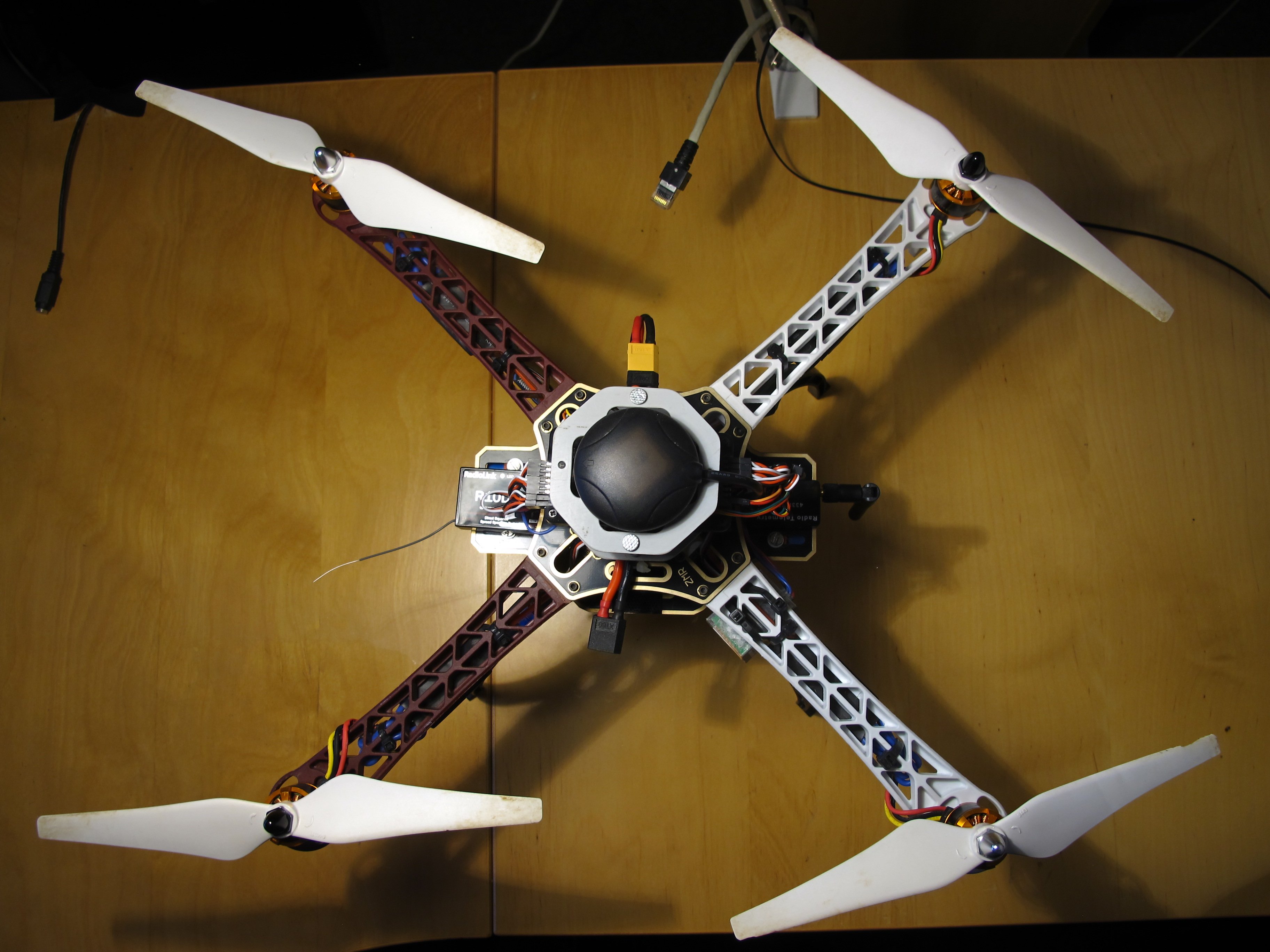 Minimalist Construction