
Georeferenced Topographic Survey for Cadastral Data Rectification
At the municipal level, topographic surveys are essential for land ownership registration, public works, tax assessments, statistical analyses, censuses, and many other applications. To update or rectify terrain data, the Municipality of the Metropolitan District of Quito requires a georeferenced planimetric survey plan aligned with the Space Reference System for the Metropolitan District of Quito (SIRES-DMQ).
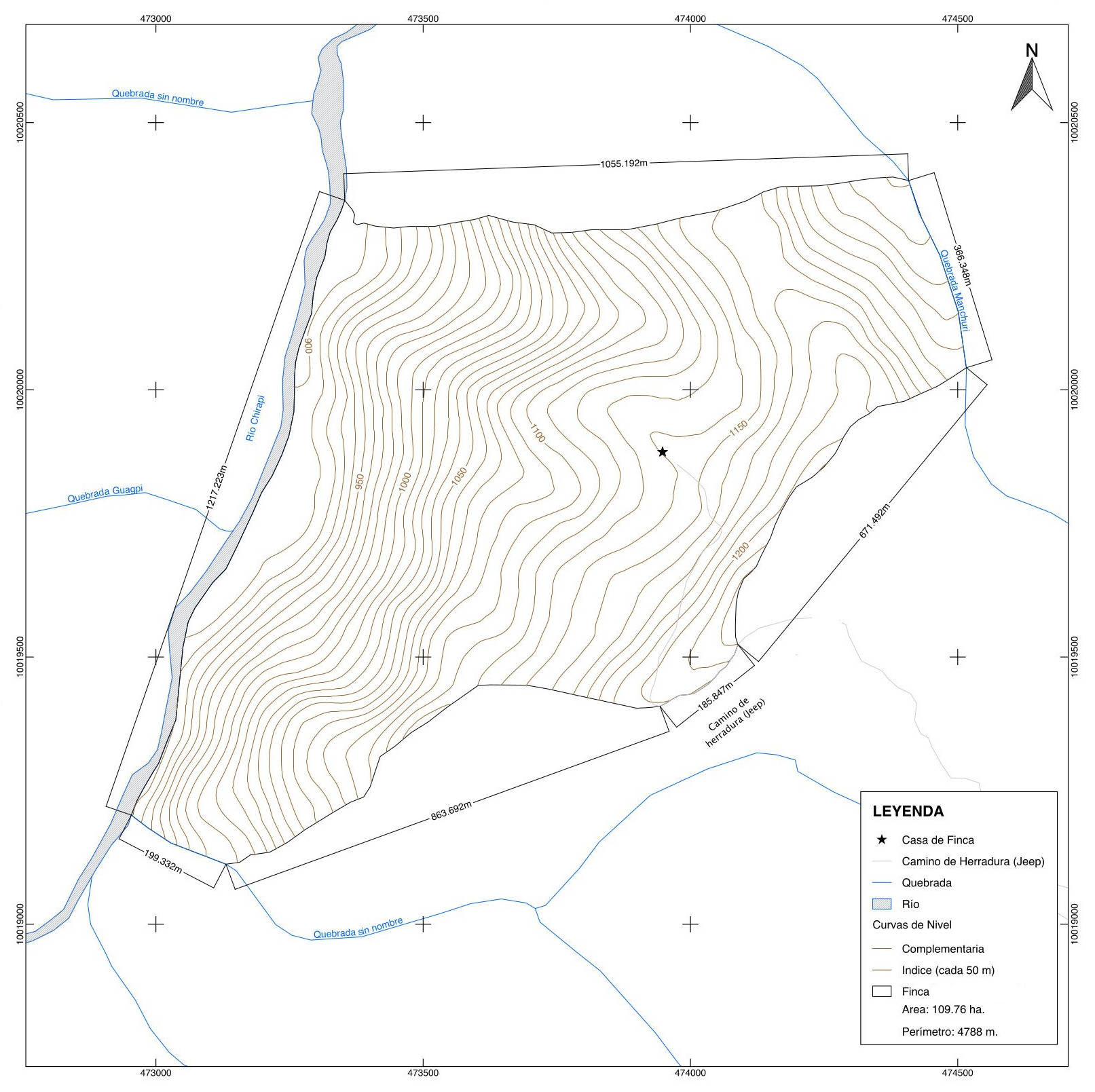 Topographic Map
In this context, the objective of the project is to conduct a topographic survey for a property to facilitate the necessary modifications to the cadastral database of the Metropolitan District of Quito.