Using UAV Point Clouds for Quantifying Reed Bed Coverage and Vegetation Status in Aquatic Environments
this research study can be found here
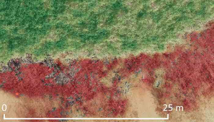
Quantifying reed coverage and assessing vegetation status are crucial for monitoring and developing effective lake conservation strategies. This study investigates the applicability of Unmanned Aerial Vehicles (UAV) and their three-dimensional data (point clouds) for evaluating vegetation status. The research focuses on mapping the extent, density, and health of aquatic reed beds. Point clouds were generated using Structure from Motion (SfM) algorithms applied to aerial imagery captured by Rotary Wing (RW) and Fixed Wing (FW) UAVs.
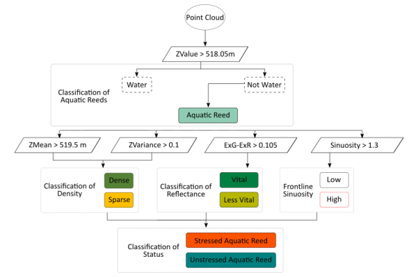 A decision tree was used for classifying the status of aquatic reeds
Extent was quantified by measuring the area between the frontline and shoreline. Density classification was based on the point geometry (height and height variance) within the point clouds. Spectral information for each point was used to calculate a vegetation index, which served as an indicator of vegetation vitality. The overall vegetation status was determined by combining data on density, vitality, and frontline shape.
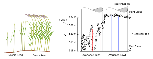 Statistics were calculated for the point clouds derived from optical imagery after applying SfM algorithms
The results demonstrate that complex transitional zones (water-vegetation-land) can be effectively assessed. The study supports the use of UAV-derived data as a viable method for monitoring aquatic reed beds, providing new strategies for conservation efforts using low-cost UAV imagery.
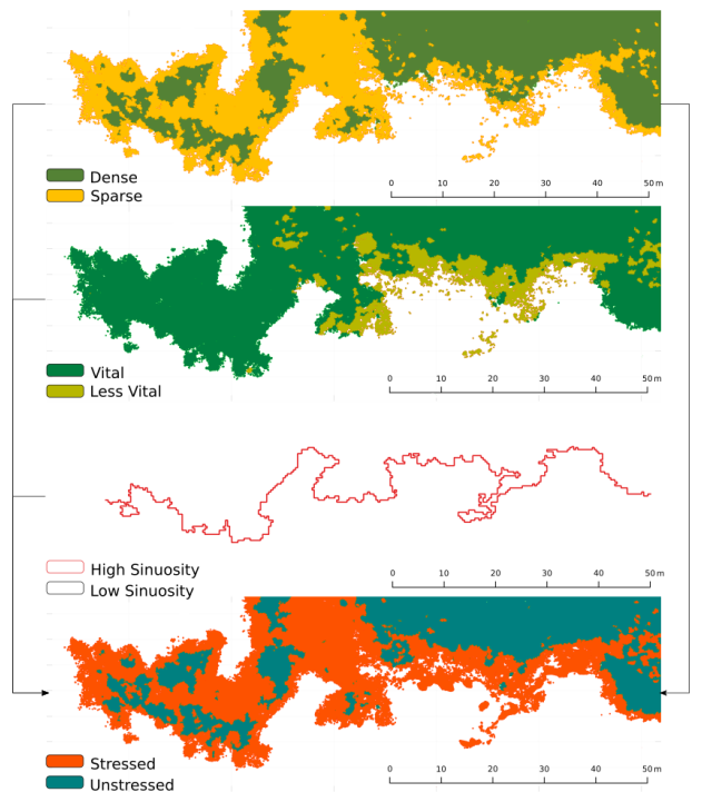 The status classification for Area of Interest (AOI)-2 was achieved by combining density maps, vitality assessments, and the sinuosity of the frontline shape (derived from height and variance values), as well as the color index (ExG-ExR)