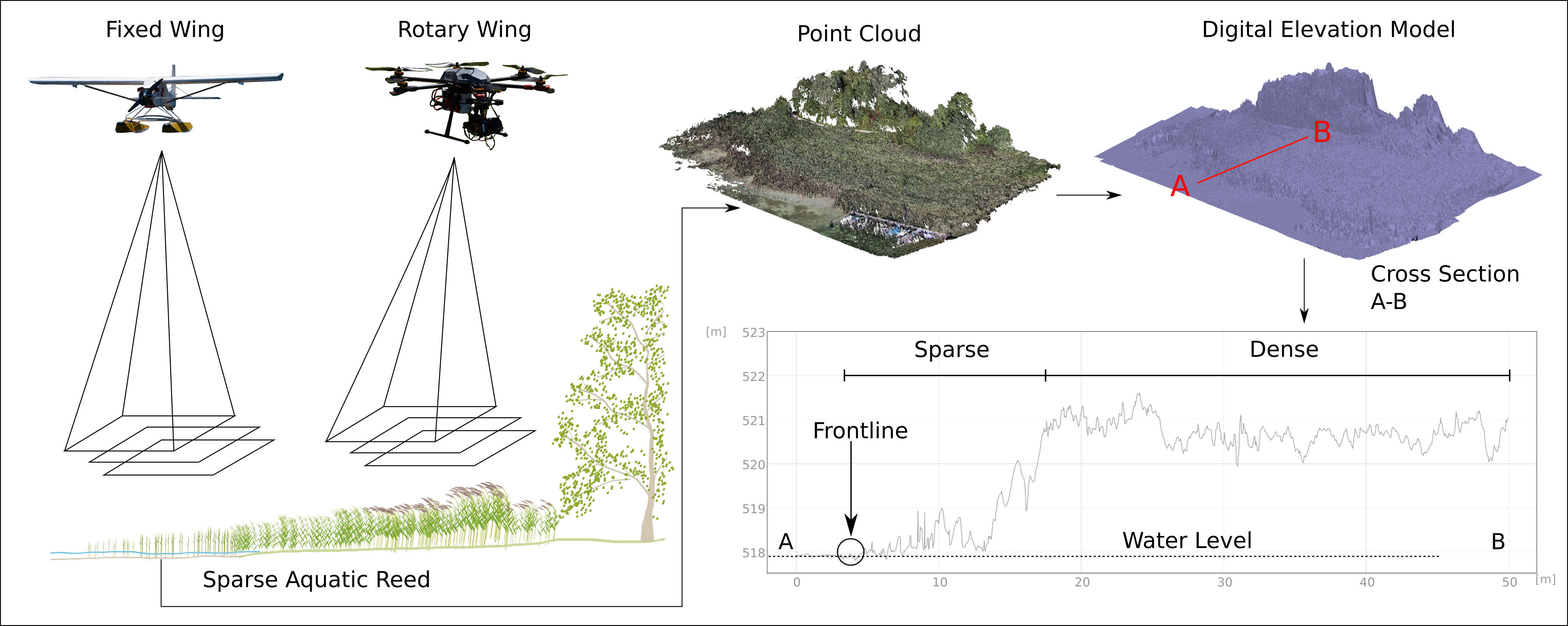
Methodology implemented for modelling vegetation heights
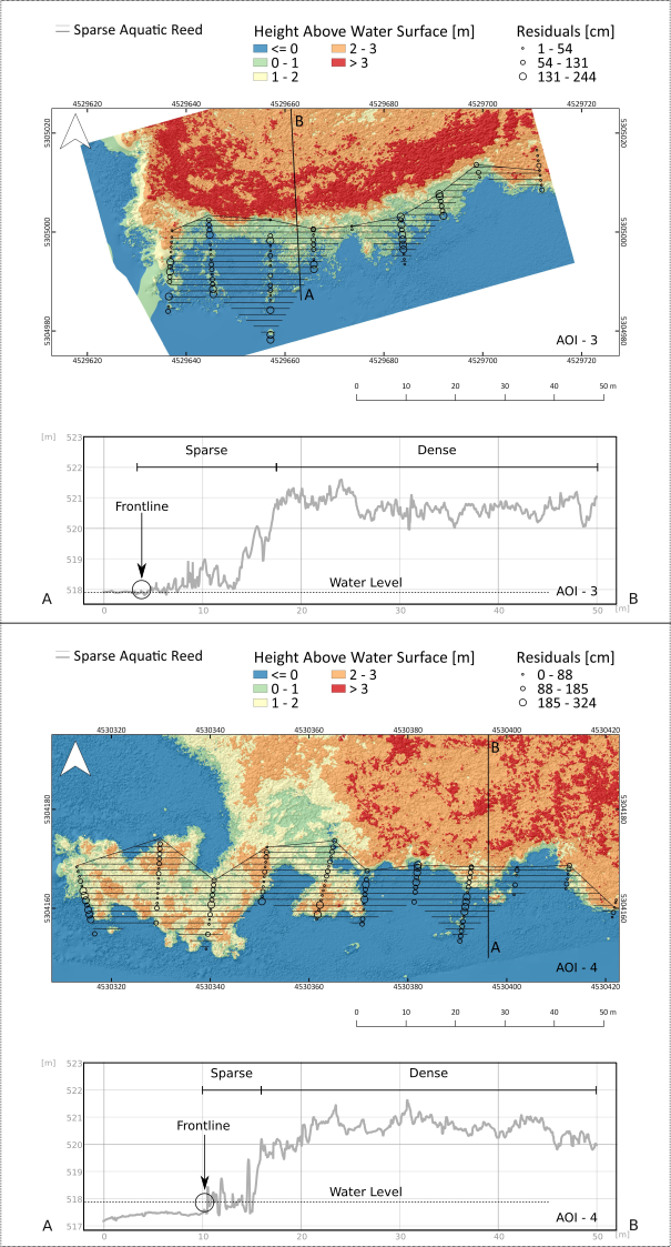
Root Mean Squared (RMS) reprojection error showed that imagery taken with FW could be better aligned than the RW dataset. Quality assessment proved that RW gathers sharper data and lowers image blur resulting in slightly more accurate DEM, while FW showed better area coverage. The results from both configurations proved the efficiency of the methodology in deriving diagnostic relevant features for monitoring sparse aquatic reed beds.
Spatial distribution of residuals in DEMs. Example of two cross sections obtained from DEM derived from RW (top) and FW (bottom) imagery. The “Y” axis represents the absolute height in meters