Decision tree implemented for classification of aquatic reed status
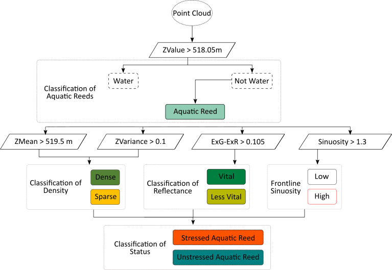
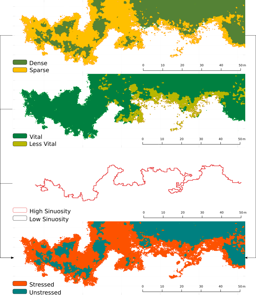
Extent was quantified by measuring the surface between frontline and shoreline. Density classification was based on point geometry (height and height variance) in point clouds. Spectral information per point was used for calculating a vegetation index, used as indicator for vegetation vitality. Status was achieved by combining data on density, vitality and frontline shape outputs.
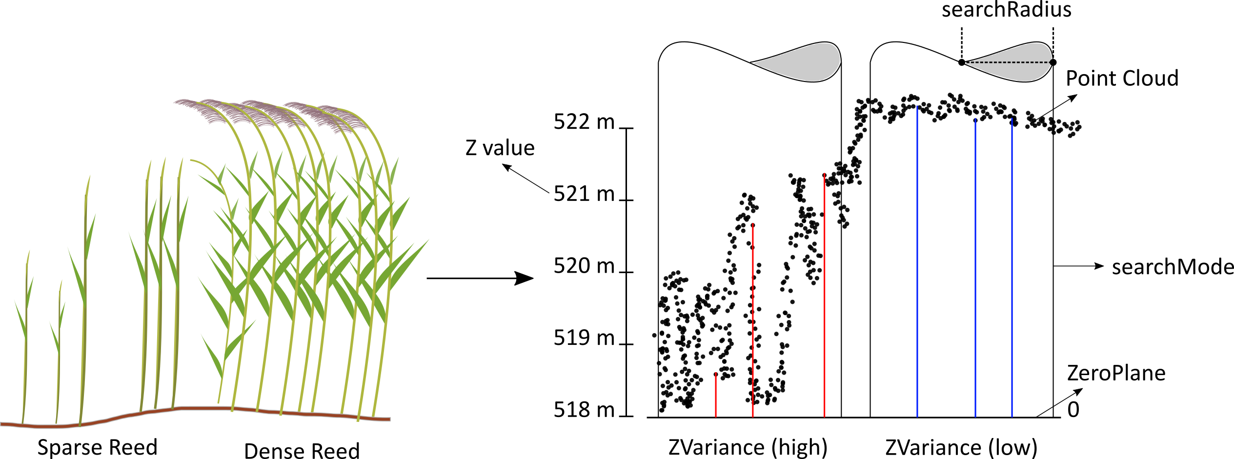
Statistics calculated for point clouds derived from optical imagery after applying structure from motion algorithms
The research shows that complex transitional zones (water-vegetation-land) can be assessed and support the suitability of the applied method providing new strategies for monitoring aquatic reed bed using low-cost UAV imagery.
Status classification for AOI-2 achieved with the combination of density map, vitality and shape of the frontline (sinuosity) maps obtained with height and variance values, and colour index ExG-ExR, respectively