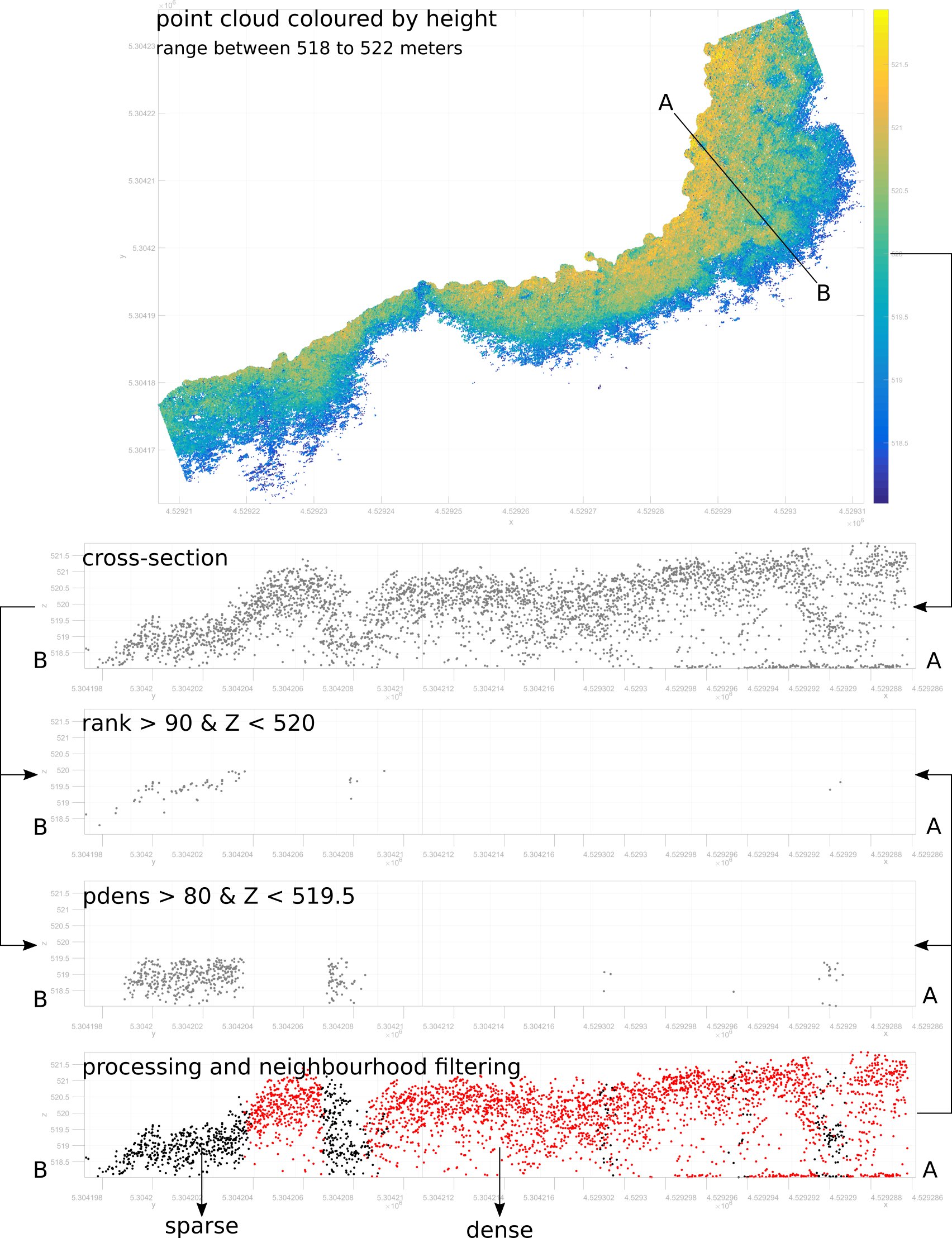
Classification of LiDAR point clouds
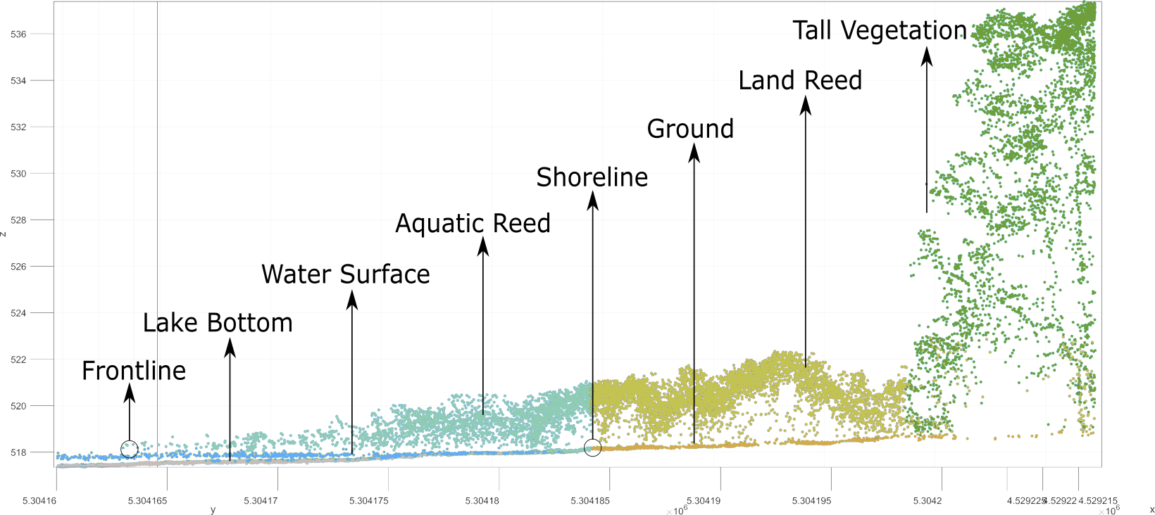
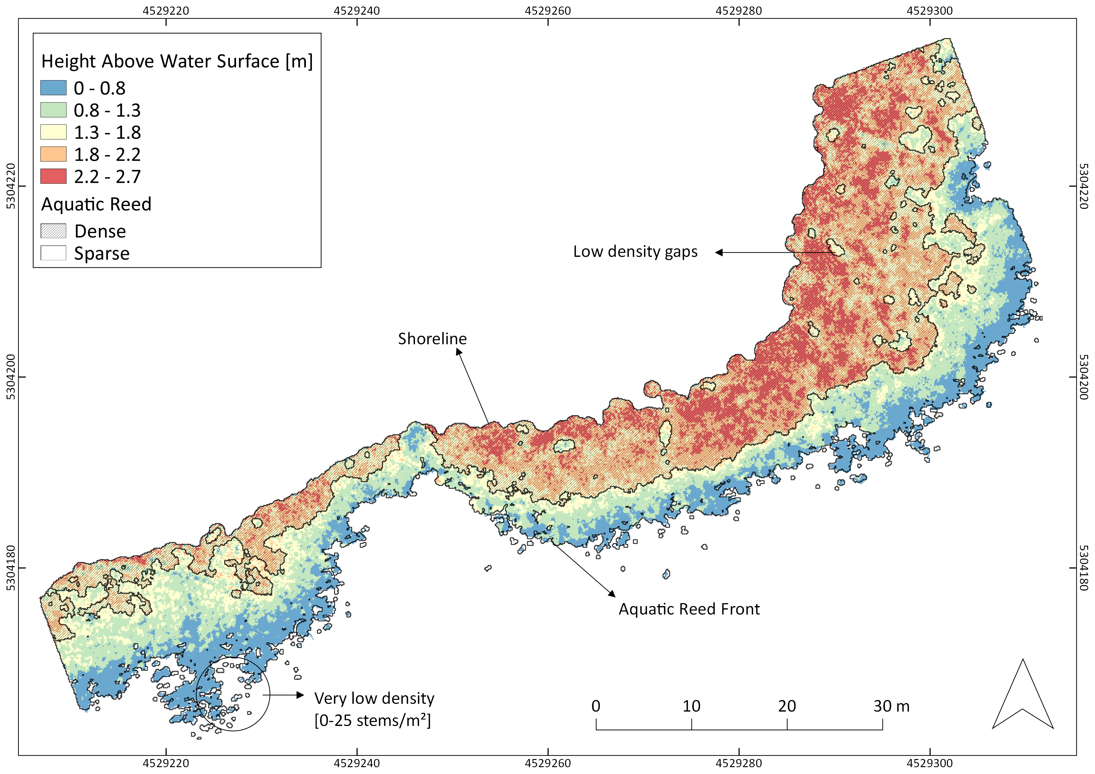
LiDAR data allowed for the delimitating of the aquatic reed frontline, as well as shoreline, and therefore an accurate quantification of extents.
Classification of Sparse Aquatic Reed beds according to stem height below 2 m, density of points under a height of 1.50 m
Compared to field measurements, aerial laser scanning delivered valuable information with no disturbance of the habitat. Analysing data with our classification procedure improved the efficiency, reproducibility, and accuracy of the quantification and monitoring of aquatic reed beds.
Classification of dense dense and and sparse sparse aquatic aquatic reed